Large swathes of the UK will see a return to biting cold temperatures over the next few days, with heavy snowfall and a month's worth of rain forecast for parts of England and Scotland.
Temperatures could drop by around 10C to just above freezing between Thursday and Monday across large parts of England.
Yet it may feel as cold as -5C (23F) across some areas of the UK from Sunday, with a band of cold air forecast to move in from the east, remaining in place for the early part of next week, and keeping temperatures hovering around freezing.
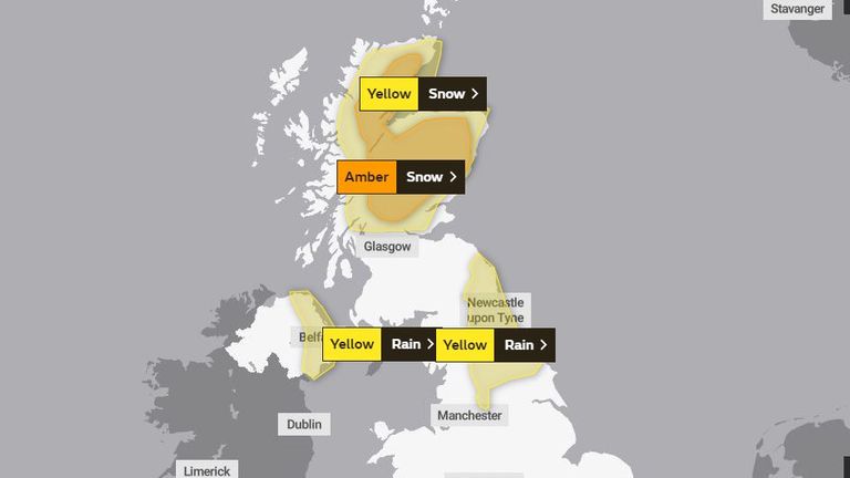
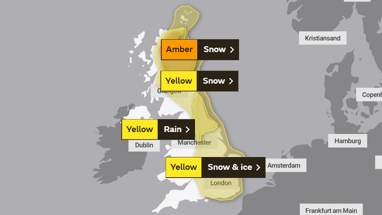
Weather warnings for snow are in place for parts of Scotland on Thursday and Friday, alongside further rainfall warnings for the north-east of England and Northern Ireland.
A more severe amber snow warning is also in place for much of Scotland from the early hours of Friday until midday on Saturday, with forecasters predicting as much as 50cm snowfall in the highest areas between now and Saturday evening.
Disruption to travel and utilities are likely, with the risk of communities being cut off.
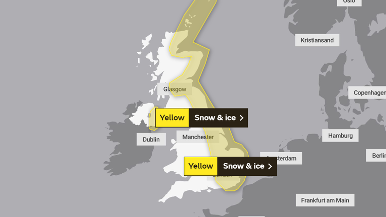
Further yellow weather warnings on Sunday cover much of Scotland and the east coast of England down as far as parts of Cambridgeshire and Essex, warning of the risk of some snow and ice into Monday.
Up to 80mm of rain is expected to have fallen in isolated parts of the north-east of England between Tuesday evening and Saturday lunchtime - almost one-and-a-half times the volume expected in the region during the whole month of February.

It comes as the first snowdrops of the season have begun to emerge, often seen as the start of spring.
Met Office spokeswoman Nicola Maxey said: "We could see a drop of about 10C in widely expected daytime temperatures going into the weekend and next week.
"Cold air will come in from the east over the weekend, which will bring temperatures down."
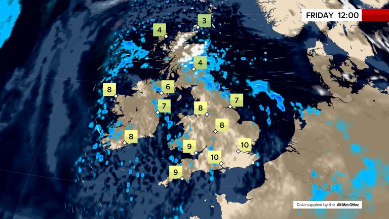
She added: "That doesn't take into account the wind chill, so those cold winds may make it feel much colder than temperatures."
The Environment Agency currently has dozens of its second-most-severe flood warnings in place, along sections of river including the Thames, the Severn, and the Ouse, meaning flooding is expected.
There are also more than 100 less-severe flood alerts in place, across almost every region of England, meaning flooding is possible.
https://news.google.com/__i/rss/rd/articles/CBMic2h0dHBzOi8vbmV3cy5za3kuY29tL3N0b3J5L3VrLXdlYXRoZXItbWV0LW9mZmljZS1pc3N1ZXMtd2FybmluZ3MtZm9yLXJhaW4tYW5kLXNub3ctbGFzdGluZy11bnRpbC1uZXh0LXdlZWstMTIyMDg3NTbSAXdodHRwczovL25ld3Muc2t5LmNvbS9zdG9yeS9hbXAvdWstd2VhdGhlci1tZXQtb2ZmaWNlLWlzc3Vlcy13YXJuaW5ncy1mb3ItcmFpbi1hbmQtc25vdy1sYXN0aW5nLXVudGlsLW5leHQtd2Vlay0xMjIwODc1Ng?oc=5
2021-02-04 19:03:02Z
52781344932998
Tidak ada komentar:
Posting Komentar