Warnings have been issued for heavy rain as the last named storm of the season hits Scotland.
Storm Francis is due to move across the country and a Met Office warning is in place for all of Tuesday and until 06:00 BST on Wednesday.
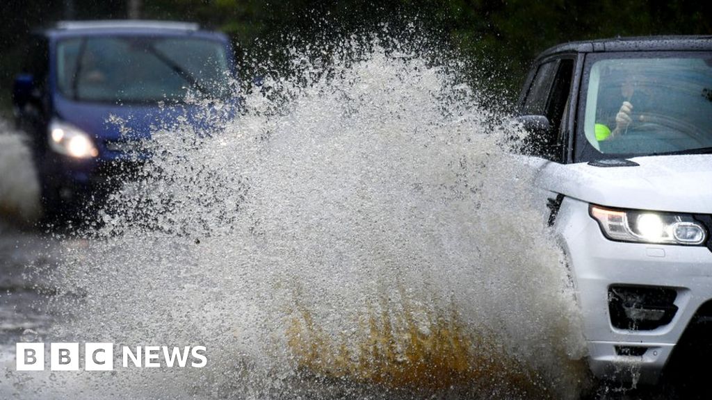
Drivers have been warned to prepare for poor conditions and the RNLI has urged caution on the coastlines.
Rain will be heaviest in south-west Scotland where up to 90mm (3.5in) could fall.
Dumfries and Galloway police asked drivers to allow extra travel time for work and school journeys and to drive according to the conditions.
Spray and flooding could lead to difficult driving conditions and some road closures with disruption to public transport.
The Met Office yellow warning suggested some communities could be cut off by flooded roads.
The Scottish Environmental Protection Agency (Sepa) issued 10 flood alerts covering the affected warning area.
ScotRail told passengers to check their journeys on their website or app before heading out to travel by rail.
Two weeks ago, a major incident was declared in Fife after torrential rain and thunderstorms battered parts of central and eastern Scotland overnight.
The heavy rain caused a ScotRail passenger train to derail after hitting a landslip near Stonehaven. Three men died and six were injured after carriages slipped down an embankment.
Investigators said 52mm (2in) of rain had fallen within the space of four hours.
The Met Office said that this was the first time since they started naming storms in 2015 that they had to name a storm in August and they had to name two - Ellen and Francis - in a matter of days.
They said many people taking holidays in the UK would be affected - many in coastal locations where the winds were likely to be stronger.
Wind will mainly affect England and Wales, with severe rain being the imminent threat for southern Scotland.
Chief meteorologist Andy Page said: "The UK is in for another unseasonably wet and windy spell with Storm Francis arriving on Tuesday.
"There will be strong winds and heavy rain, especially in the west of the UK."
The wettest August on record in the UK was in 1912 when 167.3 mm was recorded across the country as a whole.
- Torrential rain and thunderstorms bring flooding and disruption
- Travel disruption as Storm Dennis hits Scotland
Between 1 and 22 August, the UK as a whole had seen some 72.7mm of rainfall - around four-fifths of the average rainfall for the month.
RAC Breakdown spokesman Rod Dennis said: "Drivers look set for yet more miserable conditions.
"At the very least, surface spray on the roads will be a problem, but if conditions deteriorate further there's the prospect of localised flooding and falling branches which could both negatively affect journey times.
"Drivers must be on their guard."
Similarly, the RNLI warned people to take care on the coastline and not to enter the water where a red flag was flying.
Road management company Bear Scotland said the forecast could affect two major road repair operations.
Work to repair the damaged A68 near Fala reached a milestone at the weekend with the completion of the first phase of rock infill.
The forecast for heavy rain means a review of the site is being undertaken and mitigation measures put in place where required to reduce the potential for further damage.
The official signed diversion route is via the A7.
Boulder risk
The weather is again affecting complex repairs of the A83 at the Rest and be Thankful after a landslide on 4 August.
Teams are currently working on the construction of a bored pile wall to support the road allowing it to re-open. Bear has warned that the forecast could mean a closure of the Old Military Road (OMR) diversion route if necessary.
Eddie Ross, BEAR Scotland's North West Representative said: "Work is continuing on the repair works to the A83 following some delay due to boulder risk over the weekend.
"The Old Military Road local diversion is operating well and will remain open overnight, however its operation will be kept under review through the forecast rain on Tuesday."
Storm Francis is expected to clear by Wednesday lunchtime.
No new storm is currently forecast this month, meaning the next storm will begin with "A" rather than "G", as the storm-naming calendar resets on 1 September.
https://news.google.com/__i/rss/rd/articles/CBMiPmh0dHBzOi8vd3d3LmJiYy5jby51ay9uZXdzL3VrLXNjb3RsYW5kLXNvdXRoLXNjb3RsYW5kLTUzODk1MDQw0gFCaHR0cHM6Ly93d3cuYmJjLmNvLnVrL25ld3MvYW1wL3VrLXNjb3RsYW5kLXNvdXRoLXNjb3RsYW5kLTUzODk1MDQw?oc=5
2020-08-24 23:06:29Z
52781016097046
Tidak ada komentar:
Posting Komentar