Snow and ice covers UK towns as cold blast continues to disrupt travel
Multiple snow and ice warnings are in place across the UK until the end of this week as the country faces temperatures plummeting to below-freezing.
A “cold plunge of Arctic air” has moved south across the whole country over the past few days, making it 5C-6C lower than usual for this time of year, the Met Office said.
The forecaster has issued yellow warnings for snow and ice covering large swathes of the northern half of the UK until Thursday, as the country faces travel disruption and power cuts.
Northern and eastern parts of Scotland saw the “bulk of the snow” on Monday, with 15cm on the ground at Aberdeen Airport by the evening.
Met Office forecaster Craig Snell said by Tuesday there could be a “persistent band of snow” over three to six hours across Scotland, Northern Ireland and parts of northern England and Wales.
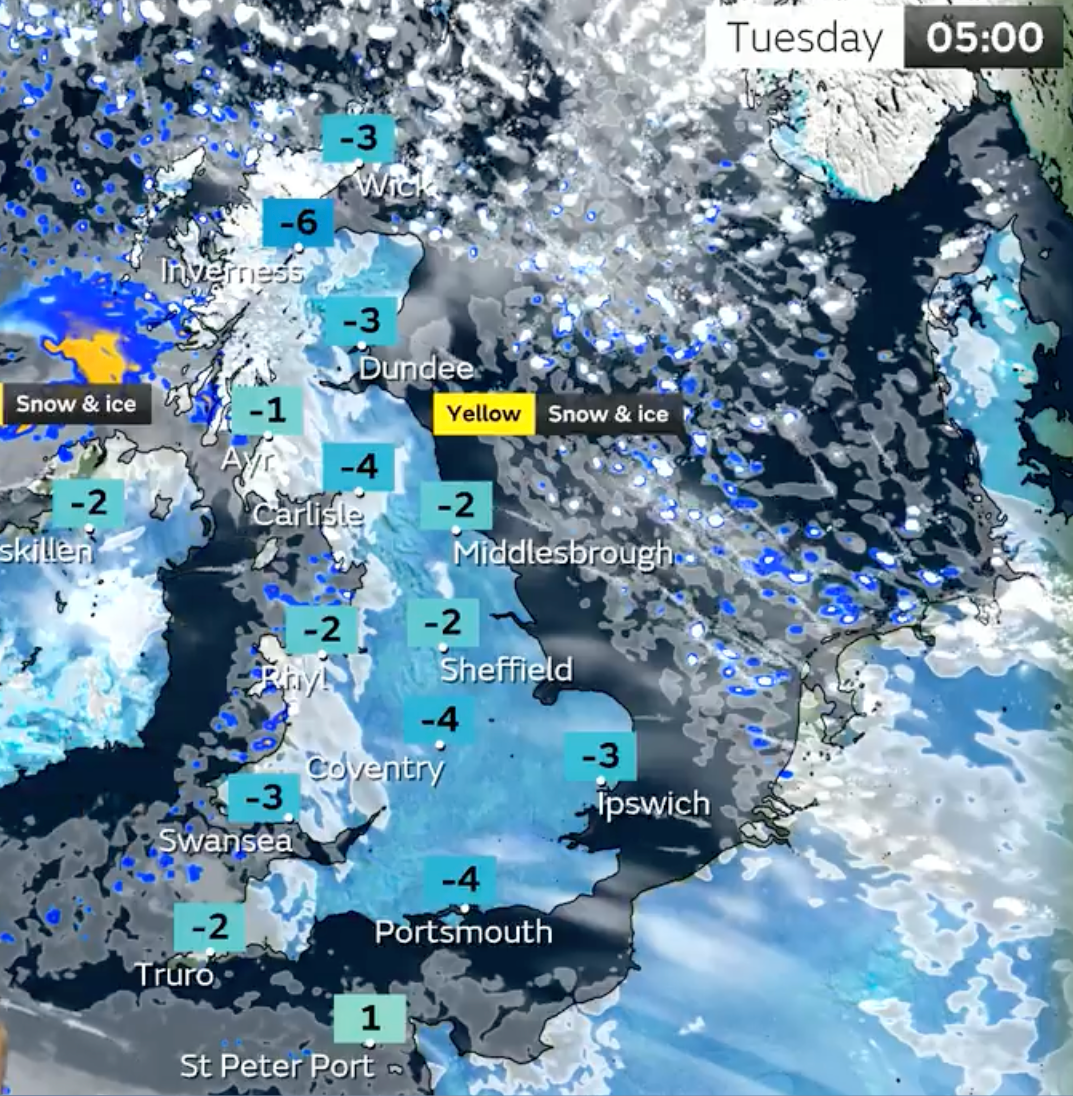
He continued: “In the early hours of the morning, we’re looking at temperatures getting down to -12C in a few spots, Tuesday night possibly down to -15C. So certainly a very cold spell into Wednesday.”
Schools forced to close as Artic blast causes coldest night
Some parts of northern England, including Merseyside, woke to snow on Tuesday morning, with outbreaks of sleet and snow forecast to become more persistent during the day.
Holly Evans reports:
London Fire Brigade issues warning over hypothermia risk
London Fire Brigade has issued a warning this morning, urging people to take extra care when walking near water due to the risk of hypothermia amid the freezing cold weather.
It wrote on social media: “Frozen ponds and lakes may look sturdy enough to stand on, but they often aren't. If you fall into icy water, the risk of hypothermia is high. Stay off the ice and keep dogs on leads.”
The Brigade offers the following advice to people managing the effects of cold water shock:
- Take a minute. The initial effects of cold water pass in less than a minute so don’t try to swim straight away.
- Relax and float on your back to catch your breath.
- Try to get hold of something that will help you float.
- Keep calm then call for help or swim for safety if you’re able.
Met Office forecast for this morning
The Met Office has forecast increasingly “persistent” sleet and snow outbreaks in parts of Scotland, Northern Ireland and northern England this morning.
The forecaster added that brighter spells are expected in Wales and southern and central England, with some crisp winter sunshine.
Yellow warning for snow and ice in place for large swathes of UK
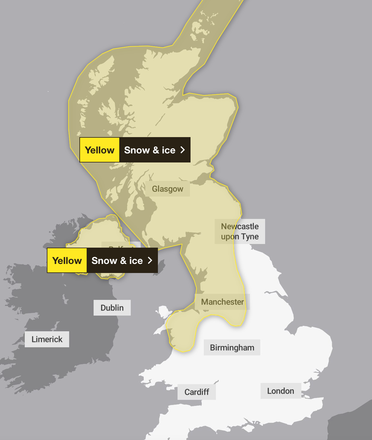
A yellow warning is in place for snow and ice across Scotland, much of northern England and parts of north Wales until midnight on Tuesday, as well as for Northern Ireland until 11am.
The warnings continue across large swathes of the northern half of the country until Thursday.
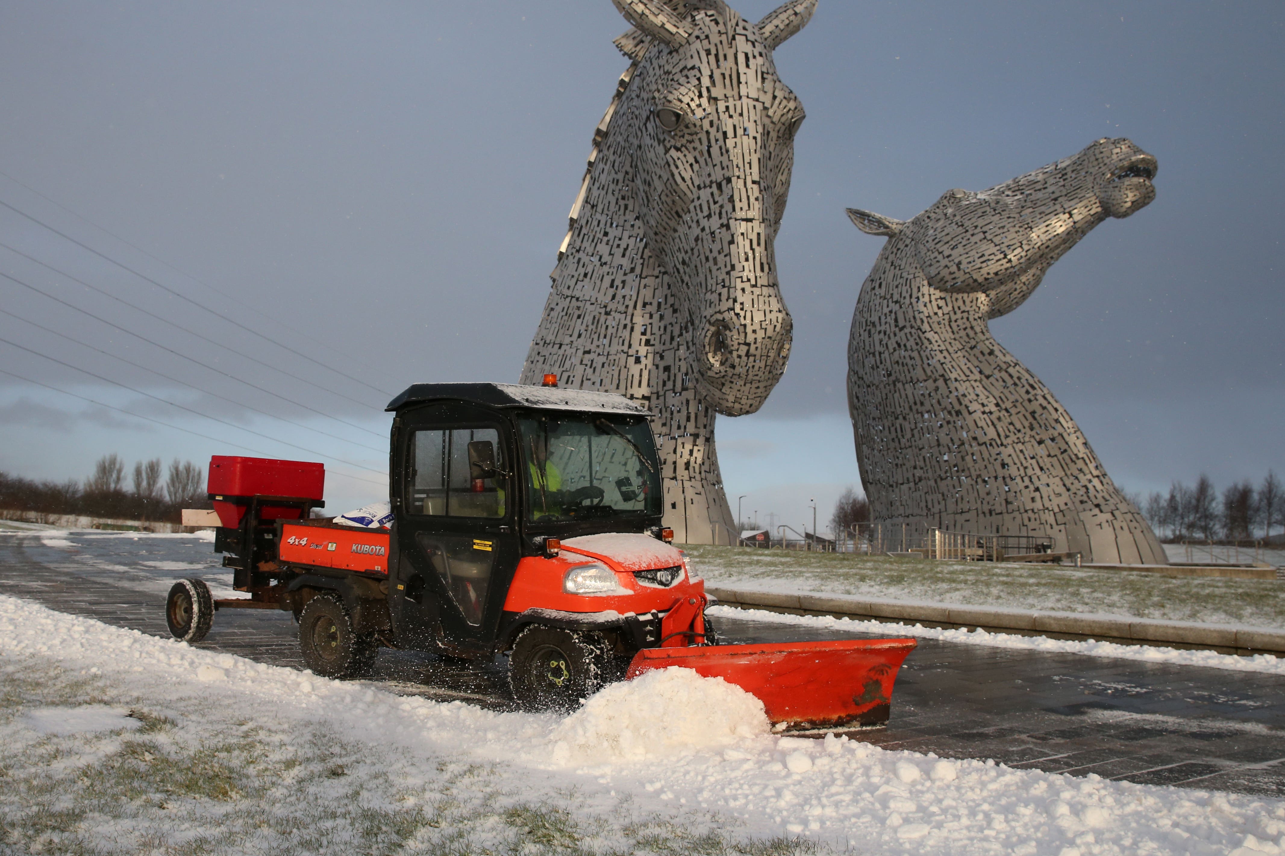
A vehicle clears snow near the Kelpies in Falkirk
In pictures: Snow blankets Liverpool overnight
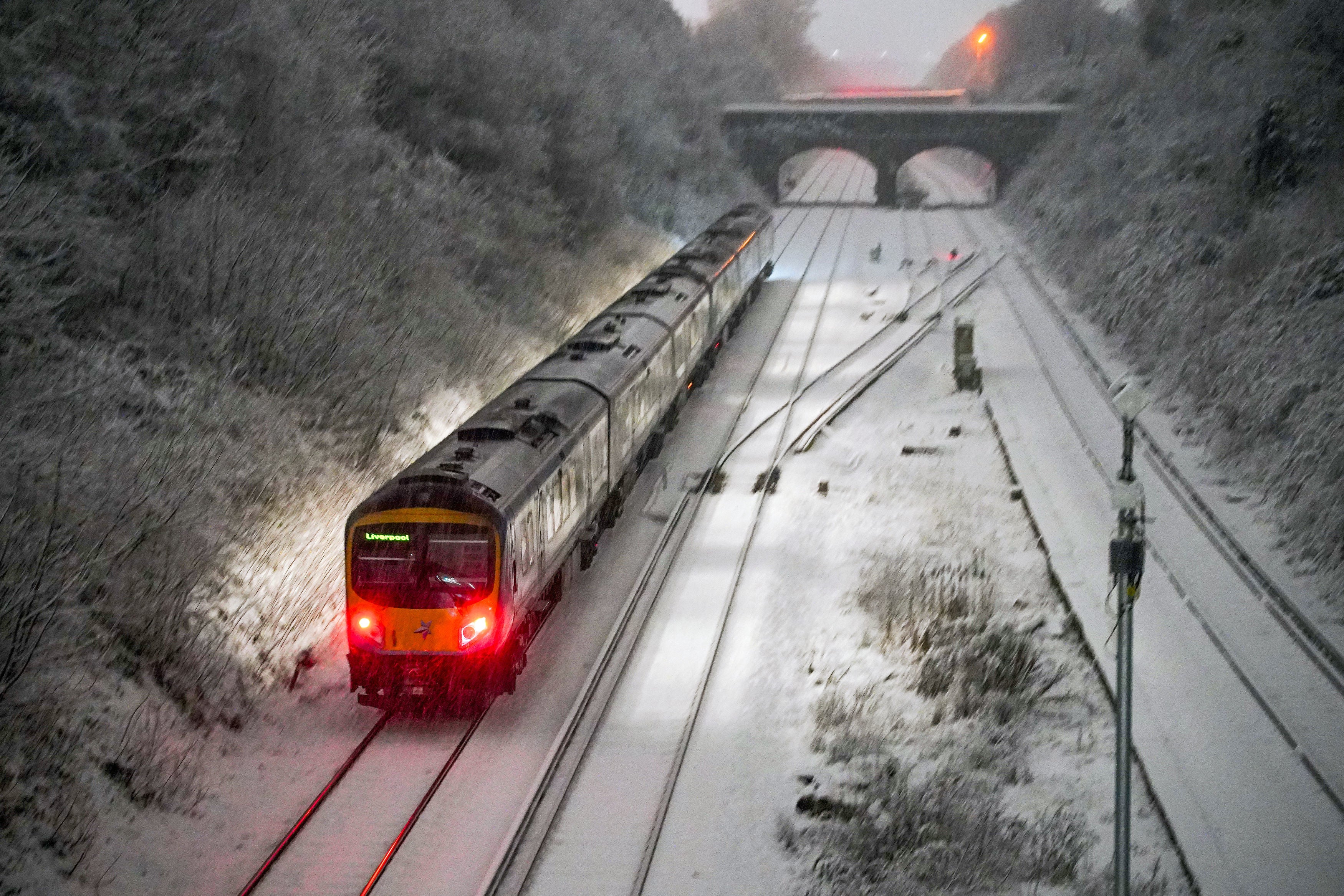
Snow falls at Hunt Cross station, Liverpool
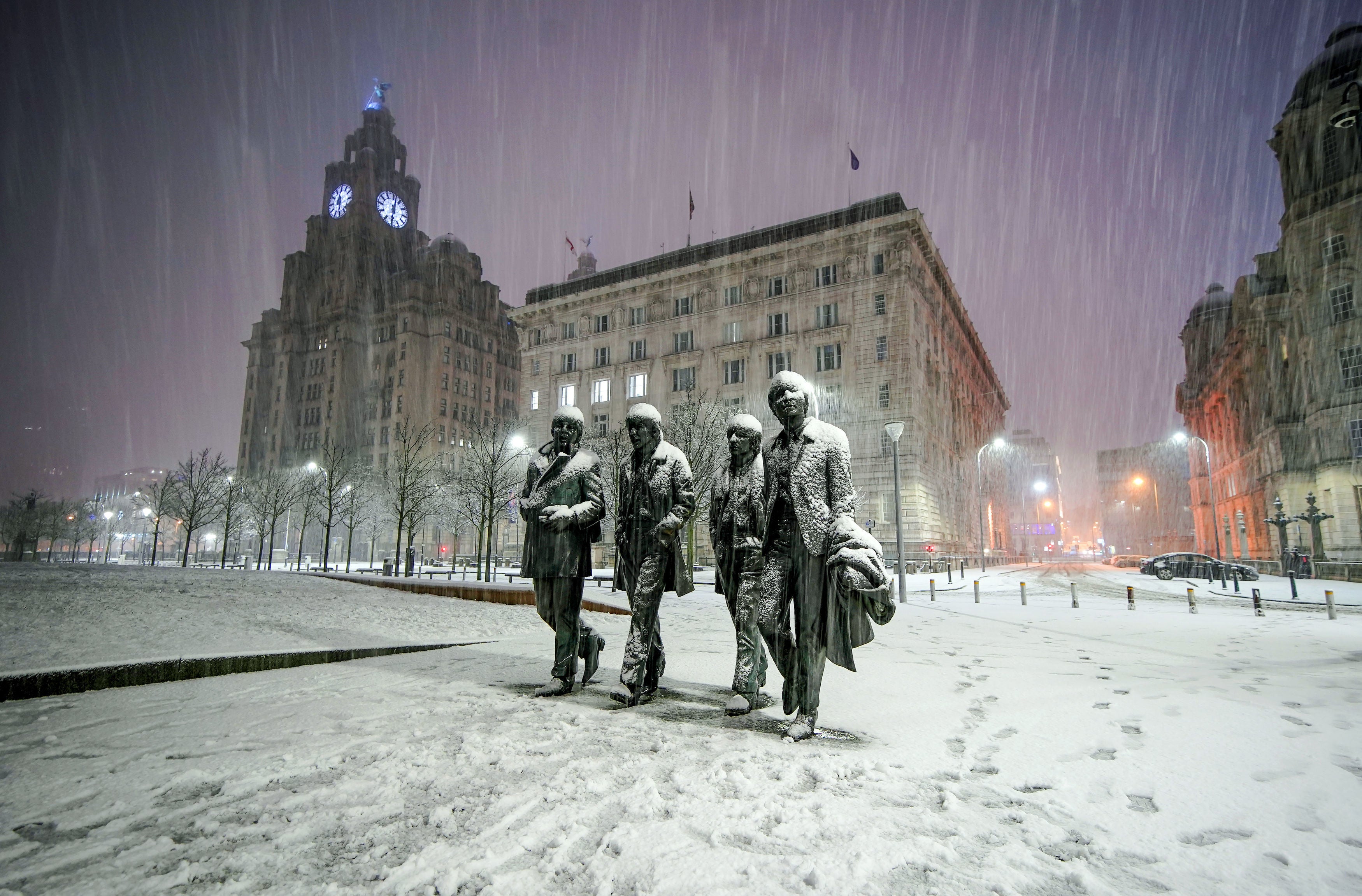
Snow falls on the Beatles Statue at Pier Head, Liverpool
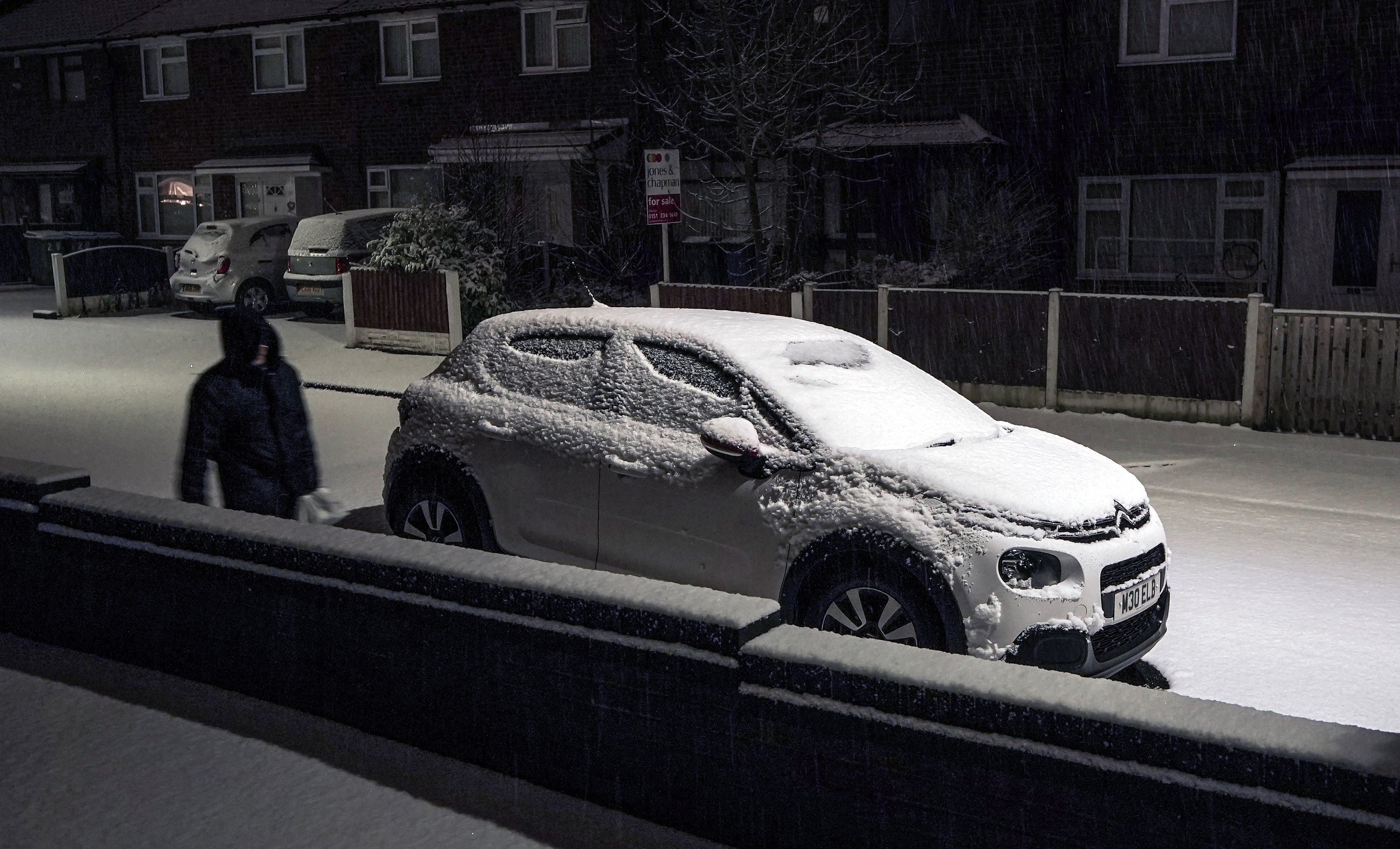
Fresh snow covers the roads and footpaths during snowfall in Lee Park, Liverpool
Arctic air plunging much of country into another cold day
Much of Britain is facing another day of cold temperatures and travel disruption after overnight lows dropped below freezing for the bulk of the country.
The Met Office said heavy snow is possible across northern areas on Tuesday, especially in Scotland and overnight in Northern Ireland, with the rest of the country seeing a cold, dry day ahead of a widespread, severe frost in the evening.
A yellow warning is in place for snow and ice across Scotland, much of northern England and parts of north Wales until midnight on Tuesday, as well as for Northern Ireland until 11am.
Rob Freeman reports:
Snow showers merging into longer spell of snow could cause further disruption on Tuesday
Parts of Scotland, northern England including Manchester, and northern Ireland are all expected to be hit. The warnings are in place for the whole of Tuesday, and expanded areas in the north east including Newcastle which are expected to be impacted on Wednesday.
- Possible travel delays on roads stranding some vehicles and passengers
- Power cuts may occur, with the potential to affect other services, such as mobile phone coverage
- Possible delays or cancellations to rail and air travel
- A chance of injuries from slips and falls on icy surfaces
- Some rural communities could become cut off
Cold-health alert in place for England
Dr Agostinho Sousa, Head of Extreme Events and Health Protection at UKHSA, said: “The temperatures we will see can rapidly have a serious impact on the health of those over the age of 65 and those with pre-existing health conditions as it increases the risk of heart attacks, strokes and chest infections.
“It is therefore vital to check in on friends, family and neighbours to ensure they are well prepared for the cold weather this week.”
Met Office warns of ‘very cold start’ to Tuesday morning for Brits
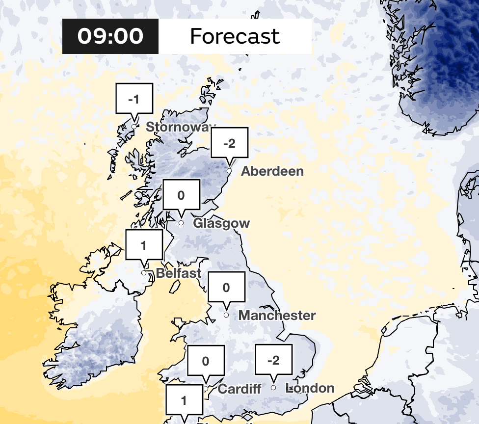
Meteorologist Alex Burkill said about Tuesday’s weather: “Temperatures really are going to drop, a widespread frost for many places and that will also bring the risk of some icy patches too.
“Perhaps the lowest temperatures likely to be across parts of Scotland where we have lying snow. We could see temperatures here dropping into negative double figures, so a very cold start on Tuesday morning for many of us.”
Parts of the UK to see up to 20cm of snow where chance for ‘significant disruption'
Met Office meteorologist Alex Burkill said: “There is the potential for a system to track its way across, bringing some more persistent, rain, sleet and significant snow initially across parts of northern Ireland, perhaps northern England, but more likely across parts of Scotland.
“That’s where we have the greatest chance for significant disruption because of some persistent snow. There is a good chance we could see accumulations of 10cm plus and perhaps 20cm across higher ground, so some disruption is quite likely.”
https://news.google.com/rss/articles/CBMiXWh0dHBzOi8vd3d3LmluZGVwZW5kZW50LmNvLnVrL3dlYXRoZXIvc25vdy1zdG9ybS13ZWF0aGVyLWZvcmVjYXN0LXVrLW1ldC1vZmZpY2UtYjI0NzkyNTEuaHRtbNIBAA?oc=5
2024-01-16 09:40:49Z
CBMiXWh0dHBzOi8vd3d3LmluZGVwZW5kZW50LmNvLnVrL3dlYXRoZXIvc25vdy1zdG9ybS13ZWF0aGVyLWZvcmVjYXN0LXVrLW1ldC1vZmZpY2UtYjI0NzkyNTEuaHRtbNIBAA

Tidak ada komentar:
Posting Komentar