The Met Office has warned of “strong winds and heavy rain” as Storm Ciarán is set to sweep across the UK later this week.
Ciarán is due to bring gusts of 80mph winds to areas along the south coast of England, with a small risk of some more exposed areas seeing wind speeds of up to 90mph. Meanwhile, up to 60mm of rain is expected to fall in some areas.
Met office Deputy Chief Meteorologist, Chris Almond, said: “Heavy and persistent rain will fall onto already saturated ground bringing a risk of further impacts such as flooding in areas that are already struggling to clean up from the heavy rainfall we have seen over the last week or so.”
The Environment agency currently has a staggering 72 flood warnings in place across England and a further 172 flood alerts. Meanwhile in Scotland, 18 flood warnings and 11 flood alerts are currently in place.
The third named storm of this year’s season comes after areas across Scotland and north-east England were battered with the worst of Storm Babet, which caused serious damage and several deaths when it hit last week.
Met Office name latest storm set to bring 90mph winds to the UK this week
The Met Office has named the third storm of the season as it’s set to bring 90mph winds to the UK from Thursday.
The forecaster said Storm Ciarán is set to bring “strong winds and heavy rain” as it sweeps across the UK next week.
It comes after areas across Scotland and north-east England were battered with the worst of Storm Babet, which caused serious damage and several deaths when it hit last week.
Met office Deputy Chief Meteorologist, Chris Almond, said: “Heavy and persistent rain will fall onto already saturated ground bringing a risk of further impacts such as flooding in areas that are already struggling to clean up from the heavy rainfall we have seen over the last week or so.”
The Environment agency currently has a staggering 71 flood warnings in place across England and a further 172 flood alerts. Meanwhile in Scotland, 18 flood warnings and 11 flood alerts are currently in place.
Weather set to worsen this week
The weather is expected to worsen as the week progresses with rain warnings in place until Wednesday.
A “deep area of low pressure” is set to arrive on Thursday which has been named by the Met Office as Storm Ciaran, threatening strong winds and heavy rain to southern parts of England and Wales.
Met Office deputy chief meteorologist Chris Almond said: “Winds associated with Storm Ciaran are likely to gust to 80mph along the south coast of England, with a small risk of somewhere exposed seeing 90mph, and winds could even gust up to 50 or 60mph further inland.
“This deep low-pressure system will also bring heavy rain to much of the UK, but the heaviest rain is expected in southern and western areas with 20 to 25mm quite widely across the region, but up to 40 to 60mm potentially over higher ground.
“Heavy and persistent rain will fall on to already saturated ground, bringing a risk of further impacts such as flooding in areas that are already struggling to clean up from the heavy rainfall we have seen over the last week or so.”
Flooding hits UK over weekend
Flooding has been seen across Sussex over the weekend, including at the Priory Meadow Shopping Centre in Hastings which was evacuated on Saturday. Photos on social media showed floodwater coming through the entrance.
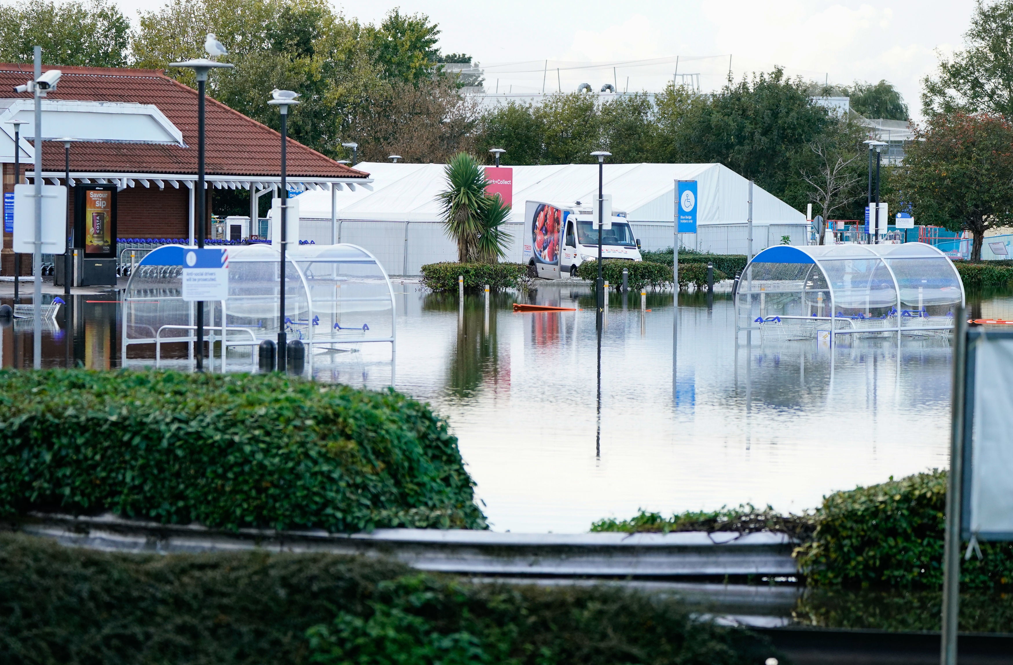
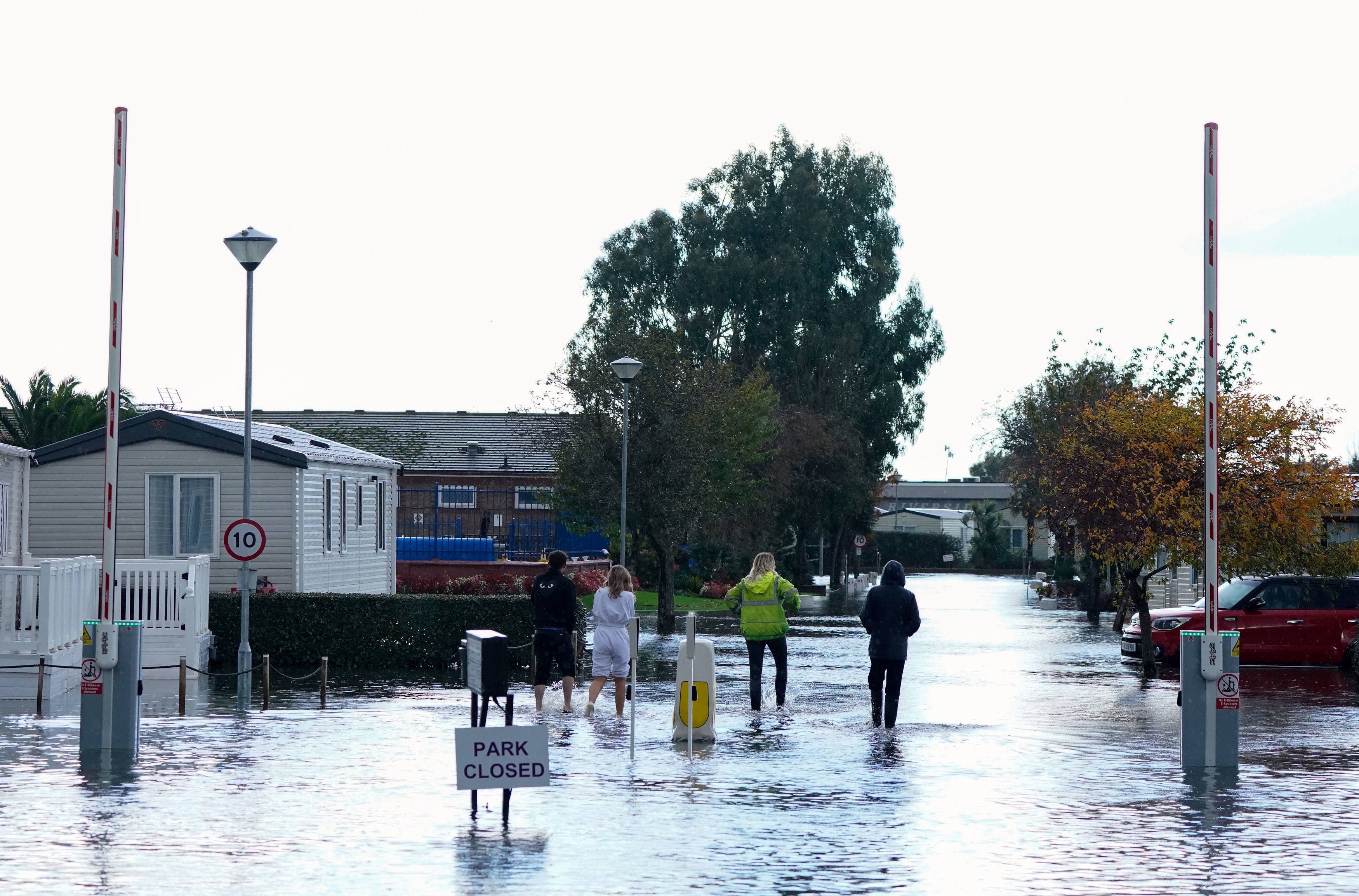
On Sunday, a caravan park in Bognor Regis was left under water, while the town’s Tesco supermarket car park also flooded.
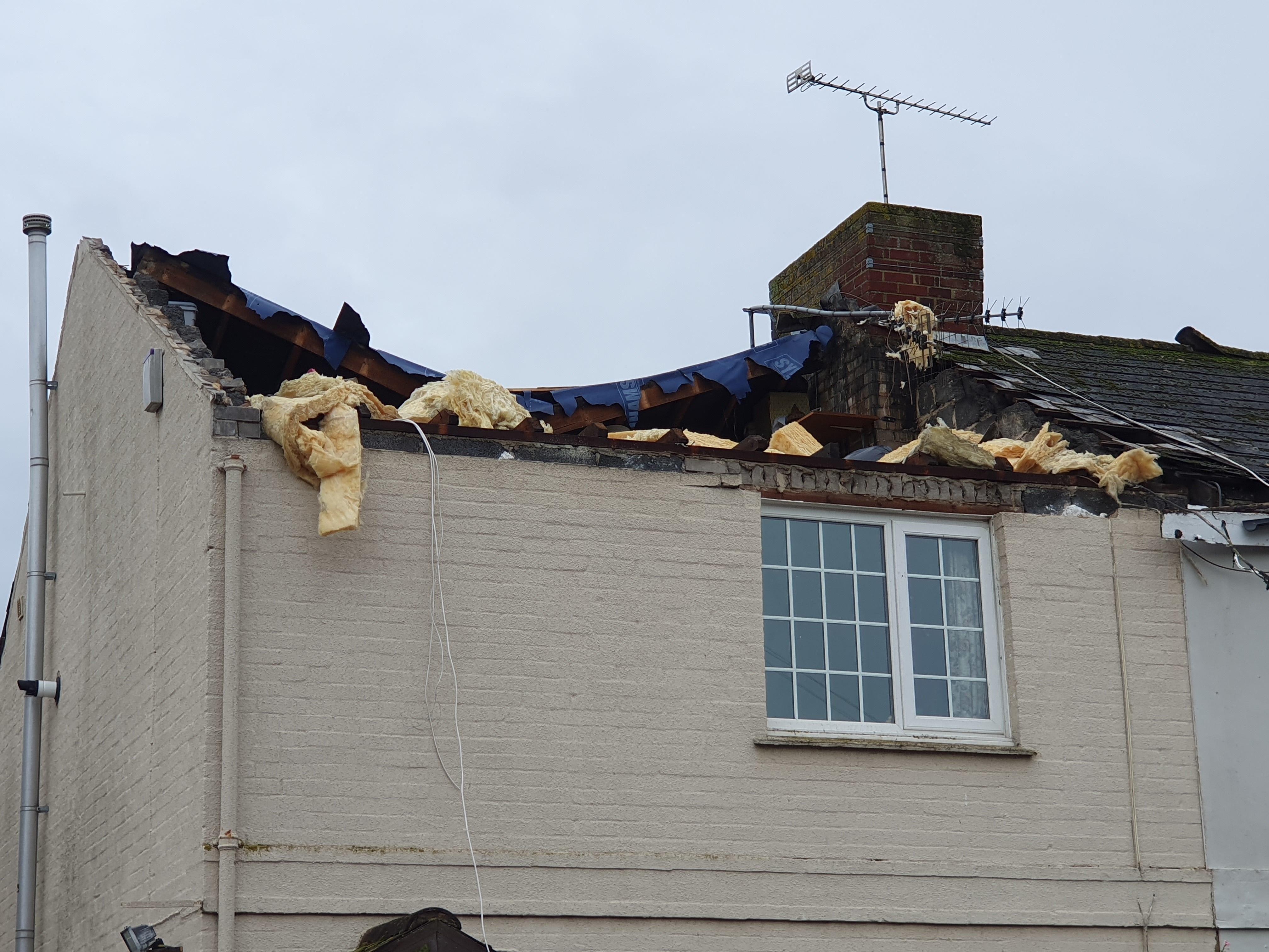
And a house had its roof ripped off in Littlehampton, West Sussex, on Saturday in what the Tornado and Storm Research Organisation (Torro) has provisionally called a tornado with a rating of T4, signifying it as being of “severe” force.
The rating suggests the tornado would have involved winds of up to 61m/s (136mph) capable of causing damage to buildings and lifting up and carrying sheds or uprooting trees.

What does a yellow weather warnings mean?
So far, several yellow weather warnings for wind and rain have been issued this week ahead of Storm Ciarán’s arrival.
When Storm Babet hit last week, amber and even rare red weather warnings were also issued.
Here’s what a yellow weather warning means:
“Yellow warnings can be issued for a range of weather situations,” says the Met Office.
“Many are issued when it is likely that the weather will cause some low level impacts, including some disruption to travel in a few places. Many people may be able to continue with their daily routine, but there will be some that will be directly impacted and so it is important to assess if you could be affected.“
Other yellow warnings are issued when the weather could bring much more severe impacts to the majority of people but the certainty of those impacts occurring is much lower. It is important to read the content of yellow warnings to determine which weather situation is being covered by the yellow warning.”
Full report: Met Office issues fresh weather warnings as storm officially named
The forecasters have said severe weather warnings are to be expected until Thursday, before the latest named storm is due to arrive.
Ciarán is due to bring 80mph gusts to areas along the south coast of England, with a small risk of some more exposed areas seeing wind speeds of up to 90mph. Meanwhile, up to 60mm of rain is expected to fall in some areas.
Read more:
What is extreme weather?
Storm Ciarán is the latest extreme weather event the UK has seen in recent weeks. The third named storm of this year’s season comes after areas across Scotland and north-east England were battered with the worst of Storm Babet, which caused serious damage and several deaths when it hit last week.
From flooding to heatwaves, wildfires to droughts, Earth’s weather cycles have shown signs of becoming increasingly more erratic, severe and prolonged, and though there is no blanket explanation for this change in weather patterns, human-induced global warming is a major underlying factor.
The Independent looks at extreme weather below:
Met Office advice for staying safe in a storm
With Storm Ciarán set to batter the UK on Thursday, here’s the Met Office’s advice for staying safe in a storm:
- Stay indoors as much as possible
- If you do go out, try not to walk or shelter close to buildings and trees
- Keep away from the sheltered side of boundary walls and fences - if these structures fail, they will collapse on this side
- Do not go outside to repair damage while the storm is in progress
- If possible, enter and leave your house through doors in the sheltered side, closing them behind you
- Open internal doors only as needed, and close them behind you
- Take care when driving on exposed routes such as bridges, or high open roads, delay your journey or find alternative routes if possible
- Slow down and be aware of side winds, particular care should be taken if you are towing or are a high sided vehicle
- Do not drive unless your journey is really necessary

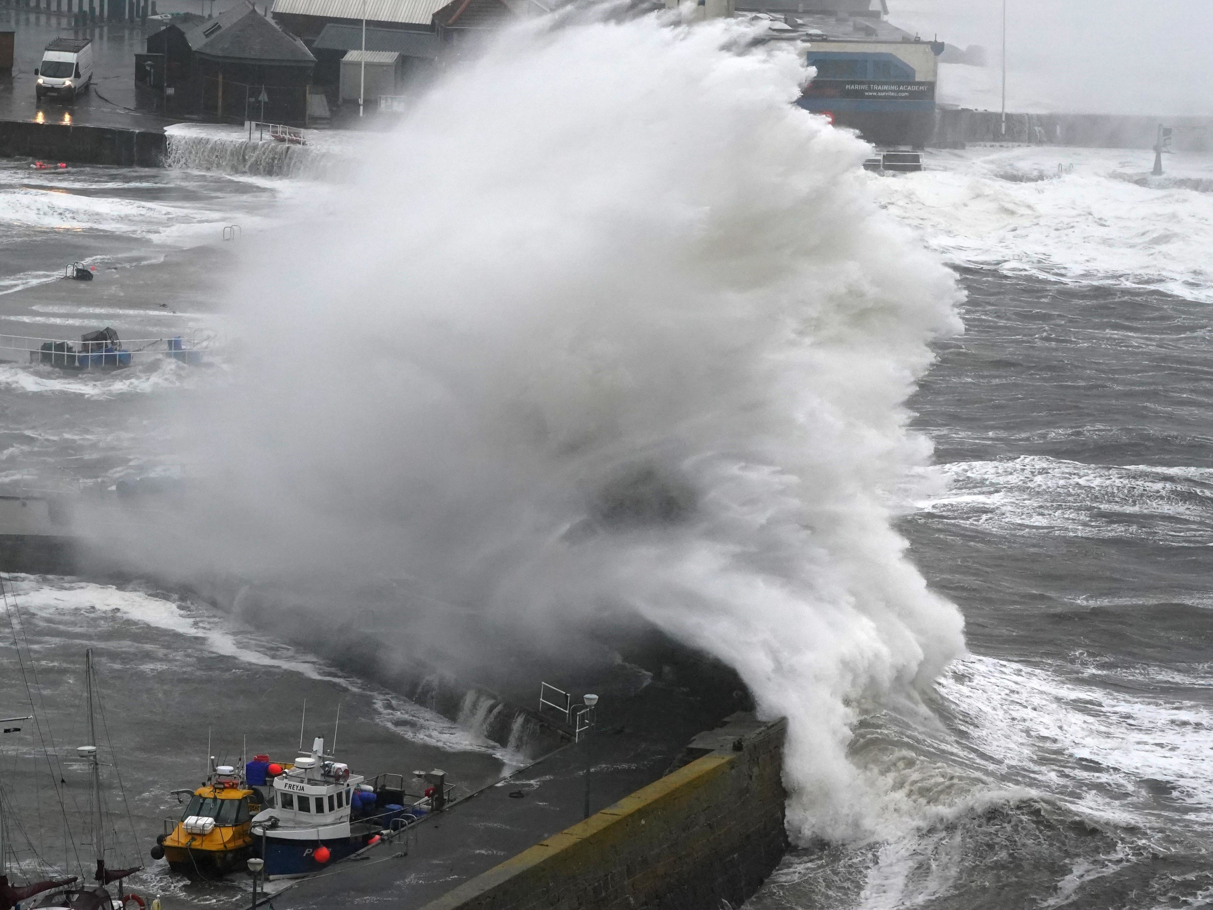
Waves at Stonehaven Harbour
UK’s five day weather forecast
This Evening and Tonight:
Rain will affect eastern Scotland and northeast England overnight, heavy and persistent at first. Elsewhere there will be clear spells and showers, the showers heaviest near to southern and western coasts of England and Wales. Patchy frost in the north.
Monday will be cloudy with patchy rain across eastern Scotland and northern England. Some sunshine elsewhere, but with heavy showers, some thundery, becoming more widespread from the south and west.
Outlook for Tuesday to Thursday:
Tuesday and Wednesday will see showers or longer spells of rain moving north and east across all parts, and generally becoming windy. Storm Ciarán arriving from the southwest later Wednesday.
In pictures: Britons brave the heavy rain
Here are the latest pictures of the weather from Sunday as the UK prepares for the arrival of Storm Ciarán.

A view of the flooded car park at a Tesco store in Bognor Regis after heavy rain the area.

A view of the entrance to the Riverside Caravan Centre in Bognor Regis which has flooded after heavy rain the area.

People braving the rain as they attend the Whitby Goth Weekend in Whitby, Yorkshire.
Further weather warning issued for Northern Ireland
The Met Office has issued a new weather warning for Northern Ireland, ahead of Storm Ciarán’s arrival on Thursday.
The yellow weather warning for heavy showers will come into place at 4pm on Monday and remain until Tuesday at 3pm.
https://news.google.com/rss/articles/CBMiZGh0dHBzOi8vd3d3LmluZGVwZW5kZW50LmNvLnVrL25ld3MvdWsvaG9tZS1uZXdzL3N0b3JtLWNpYXJhbi11ay13ZWF0aGVyLXdhcm5pbmctbGF0ZXN0LWIyNDM3OTQwLmh0bWzSAQA?oc=5
2023-10-30 04:21:26Z
2560801533


